map projection buurt.shp #1
Description
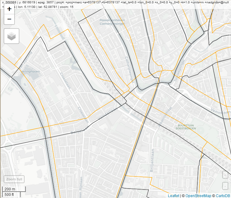
Several participants of the maptime030 workshop noticed the boundarys of the 'buurt.shp' map (downloaded from CBS!) where somewhat off ....
This can be fixed with:
u.buurt.sf %>% st_transform(28992)
some juggeling with mapview shows us the differences
u.buurt.sf %>% mapview(fill=NA,  color='orange') +
 u.buurt.sf %>% st_transform(28992) %>% mapview(fill=NA)
(black lines give the proper location)